
October 22nd, 2015. On Thursday, I dropped my kids off at school then drove towards a trail-head. I’ve been trying to get out at least once per week to do some hiking. Because of the necessity to be done in time to pick my kids up, I would have to stay reasonably close to home and the hike would have to be either a loop hike or an in/out hike since it would typically be too time consuming to try to set up a shuttle.
I decided to go to the Ellicott Rock Wilderness Area and do a 10.2 mile loop that would incorporate three trails and a short road walk. I’ve actually done this hike before in the snow, which was lots of fun. This time, I started at a different point in the loop and hiked in the opposite direction.
From the Burrels Ford campground parking area, I began on a section of the Foothills Trail which climbs Medlin Mountain for 3.9 miles as it makes it’s way to Fish Hatchery road. At about 4 tenths of a mile from the start of my hike were these large boulders that formed a sort of Fat-mans squeeze.

Also along this section, I passed this large, bluish-black mushroom that I thought was kind of unique and appealing in it’s own way. The early morning climb up Medlin Mountain, alone in a fairly thick forest, left me feeling a little bit isolated and vulnerable.

Once I reached the road, I followed that downhill to the Walhalla State Fish Hatchery where I picked up the East Fork Trail. Near the beginning of the East Fork Trail is a boardwalk that leads to a side entrance into the fish hatchery. The second image is of a bridge that crossed the East Fork early in this portion of my hike.


Inside the fish hatchery, there are two rows of pools. Each row has three or four pools containing hundreds of trout. The trout get progressively larger from one end of the rows to the other. According to their website, the WSFH produces and stocks approximately 500,000 trout annually. The waters beyond the bounds of the hatchery are naturally popular with fishermen.

After my brief visit to the hatchery, I continued my hike. Along the way I passed a couple of impressive rock formations. One in particular is so large that it was not possible to capture the scale in just one picture.


The East Fork Trail is never far from it’s namesake. The sounds of water cascading downstream keep you company all along this segment.


After hiking 2.5 miles, I reached the junction for the Chattooga River Trail where I turned sharply left and followed that back towards Burrels Ford and my point of beginning.

During the Chattooga River portion of my hike there were several opportunities to walk down to the bank of the river. More than 21 years ago, on our honeymoon, my wife and I had taken an all day guided rafting trip on the Chattooga. That was long before we had any inkling that we would someday live in the region.


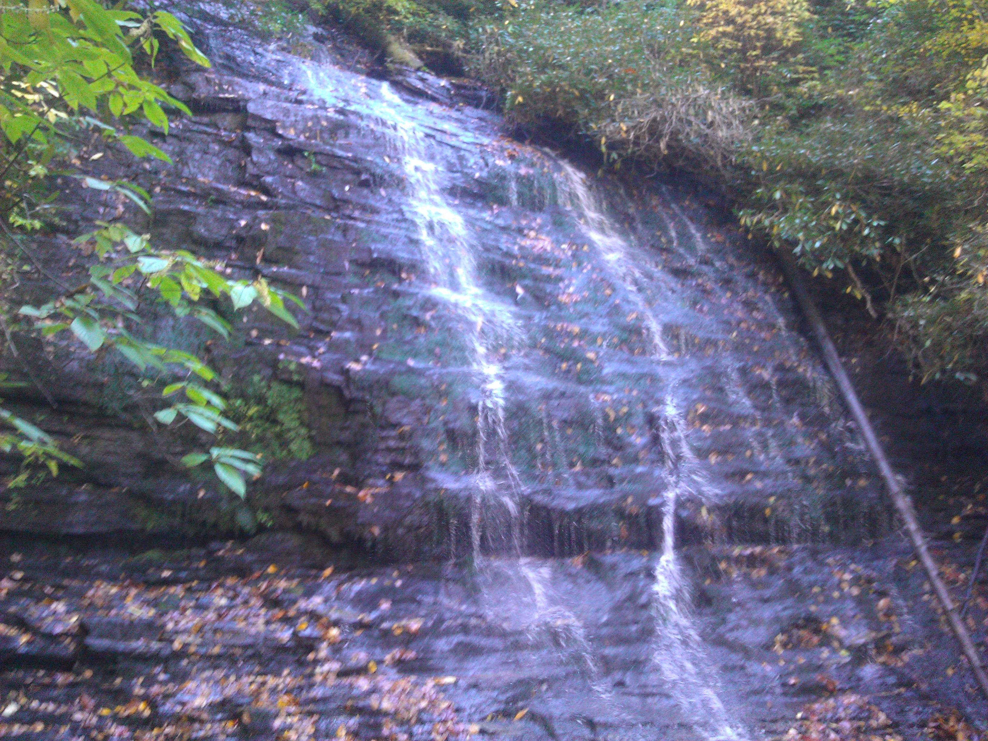
Probably less than a half mile from the end of my hike was a short spur trail that climbs to near the top of Spoonauger Falls. The falls are 50 feet high, set back in the hillside and surrounded by heavy vegetation.
I finished my hike soon enough that I even had time to stop and eat a quick lunch before driving back and picking my kids up from school. Mission accomplished.

Very nice desciption of the trail. I think the i’ll take the family on a day hike on teh fsh ahtchery loop this spring. thanks
Thank you, Scott. It’s a nice hike and the Fish Hatchery is pretty impressive. One of the pools has trout in it that are kept for display that weigh between 5 and 15 pounds.